by Michael Bailey | Jun 22, 2020 | Uncategorized
Welcome to WordPress. This is your first post. Edit or delete it, then start writing!Substations Hot Spot Detection

.
SPC realizes keeping the lights on, or reducing the duration of power outages, are critical to their customers’ satisfaction. Electric utility companies work tirelessly to maintain service, improve their aging infrastructure to eliminate devastating brownouts and blackouts, while meeting the increasing demand for low-cost energy, to improve customer satisfaction. Every transmission and substation has thousands of connections and terminations; they are often located high up in a bus or overhead structures.
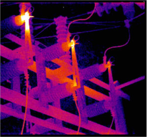
SPC is here to support utility companies in attaining the early detection of potential heat-related failure modes. We use thermal imaging sensors to inspect components, analyzing the severity of potential problems, and allowing utility companies to take corrective action to prevent future failures before they happen and keep their system operating efficiently and safely.
SPC uses the Zenmuse XT2, an integrated high-resolution FLIR thermal sensor, and a 4K visual camera to scan for temperature differences, anomalies, and hot spots to pinpoint problem areas.
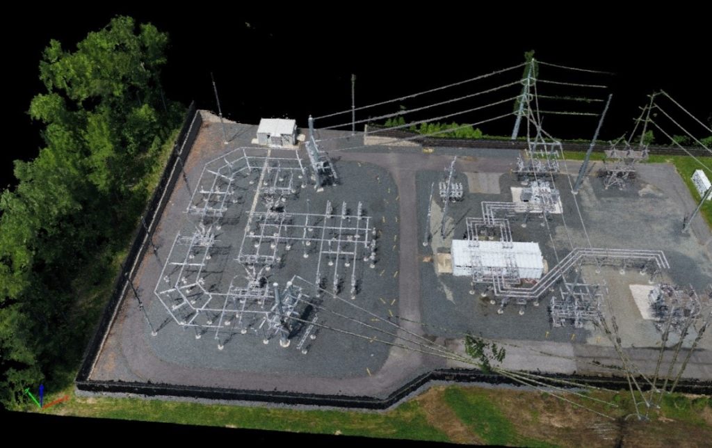
SPC employs the practice of photogrammetry, in surveying, to perform site planning, topographic mapping, earthwork volume estimation for proposed access roads, and image-based mapping “ortho maps” (orthophotography).
Our Aerial Photography and Photogrammetry Surveying service is a useful way to provide visual evidence of construction progress and identify potential design issues.
The Photogrammetry is a surveying and mapping technique which has several applications in the electric utility sector. SPC offers several services to our clients.

Aerial services include, but are not limited to:
• Generate a point cloud and three-dimensional model of the site.
• Produce high resolution ortho-maps of the site.
• Provide progression reports/ construction site monitoring.
• Document (pictorially) all work performed weekly.
• Support Environmental & Safety monitoring.
• Confirm site restoration.
• Produce accurate topographic map models, with indexed contour lines.
• Capture aerial images of an active construction site.
• Provide a permanent record of installation.
• Provide a digital terrain model (DTM).
• Calculate volumetric data of soil piles.
• Calculate volumetric of soil removed.
• Perform detailed inspections of subjects i.e. poles, towers, or bridges.
Commercial Grade UAV Platform
Socium Power Consultants has invested in the latest technology and equipment within the drone industry. The M210 V2 provides dual downward-facing payloads or a single upward-facing payload and expansion ports with onboard SDK compatibility and XT30 power output.
Our M210 V2 is the ultimate platform that combines a rugged design and is simple to configure to work as a solution for various industrial applications. Improvements to the M200 Series V2 enhance intelligent control systems, flight performance, and add flight safety and data security features.
We recognize that all businesses are different and aerial photography will vary from client to client. A consultant will work with you to identify the imagery need most pertinent to your business.
AES-256 Encryption
The AES-256 encryption keeps your data transmission secure so you can be sure that your critical information stays safe. All photographic information and data that is acquired is processed locally on workstations and never goes on the internet.
Obstacle Avoidance
A robust Flight Autonomy system with front, bottom and upper sensors detects and avoids obstacles while enabling precision hovering so that you can fly with confidence.
Anti-Collision Beacon
Equipped with new top and bottom anti-collision beacons, the V2 drones are visible at night or in lowlight conditions, making operation in less than ideal conditions safer. Built-in collision avoidance beacons ensure visibility at 3 statute miles and beyond.
DJI AirSense
With a built-in ADS-B receiver, the DJI AirSense technology enhances airspace safety by automatically providing the operator with real-time information about nearby airplanes and helicopters.
IP43
IP43 construction resists water and snow, while also protecting against dust & dirt.
OCUSYNC 2.0
With OcuSync 2.0, pilots can reliably operate out to nearly 5 miles.
Recent Comments